
Current projects include innovative, quasi-experimental monitoring work with university and conservation partners on the ground in eastern Indonesia and the Northern Mozambique Channel, as well as work building on a unique global synthesis of MPA governance and ecological data
Sunda banda seascape (SBS), eastern indonesia
A global conservation priority area within the Coral Triangle, using a regional monitoring approach, and evaluation system developed. Learn More →

Bird's head seascape (BHS), indonesia
A streamlined monitoring and evaluation program integrated impact evaluation into the design, implementation and adaptive management of a network of marine protected areas, with results forthcoming. Learn More →

Indonesia’s 10 year mpa vision
A collaboration of conservation NGOs partnered with the Government of Indonesia to co-lead the development a 10-year Vision for MPAs for Indonesia. The resulting Vision document identifies seven areas of work and includes an associated roadmap to achieve national targets by 2030 (32.5 million ha of MPAs established by 2030; 20 million ha of MPAs effectively managed by 2030). A parallel science report was also developed to support the Vision document, detailing the status and trends of MPAs in the country: currently there are 23.9 million ha of protected areas (7.3% of Indonesian waters). Learn More →

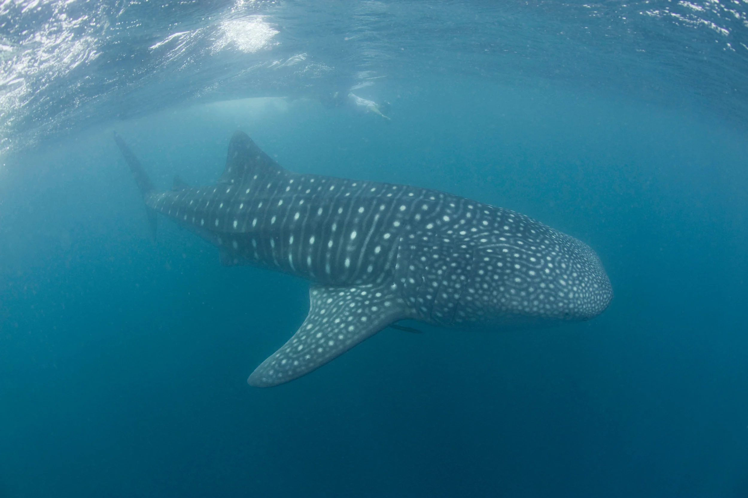
© James Morgan / WWF-US
The northern mozambique channel, coastal east africa
A global biodiversity hotspot and priority area for marine conservation, our work here focuses on understanding gaps, outcomes, and learning around community-based natural resource management. Learn More →

© Brent Stirton / Getty Images / WWF-UK
Solving the mystery of mpa performance
Building on the SEYNC Pursuit with the same title, this research advances work done by the Pursuit by examining linkages between specific MPA attributes and social and ecological outcomes. Focus is on topics such as MPA spillover, MPA fisheries regulations, MPA impacts on human well-being, socio-environmental variability, MPA causal pathways, etc. This work is being led by Luc Hoffmann Institute Fellow and Smith Conservation Research Fellow David Gill. Learn More →

Marine Evidence Gap Map
Assessing evidence related to conservation interventions for coral reefs, mangroves, and seagrasses, in order to better understand what we know about links between interventions and outcomes (both positive and negative, for people and environments) and to identify gaps in our understanding of these linkages. This is a partnership with WWF and Duke University.

Alliance for Conservation Evidence
The Alliance is an NGO-led collaboration focused on generating, synthesizing, and using evidence for community-based natural resource management The first goal is to build the evidence base through learning projects on community-based marine conservation in Indonesia, community forests in Latin America and Asia, and locally-managed marine areas in the Pacific. Second, the Alliance will explore new and emerging practices for integrating evidence into the design and implementation of initiatives at multiple scales. Learn More →

MERMAID
MERMAID is an open source data platform for science and conservation that uses coral reef data collection and visualization for decision making.
Blue rivers
The long-term resilience of tropical coastal habitats, such as mangrove forests and coral reefs, often depends on upstream river conditions- a connection often overlooked by conservation managers. To draw attention to this challenge and increase holistic river-coastal management, WWF has recently launched an initiative—Blue Rivers—that will identify 8-12 rivers crucial for ocean conservation. A global analysis of rivers, mangroves, coral reefs, and marine protected areas was completed – finding that human impacts on rivers are good predictors of coastal ecosystem health. Next steps are to finalize the list of Blue Rivers, based on locations with high potential for conservation impact. WWF will then advocate for these Blue Rivers and adjacent coastal areas at international forums, and joined-up river, mangrove, and coral reef management plans will be initiated and implemented. This will include supporting the designation and management of new marine protected areas. By considering connected ecosystems, this project will maximize conservation impact and increased ocean protection in some of the most vulnerable coastal areas globally. Learn More →

Great sea reef survey
The Great Sea Reef (GSR) of Fiji, the third longest barrier reef system in the world, stretches over 450 km from Viti Levu to Vanua Levu. The last systematic survey of the GSR, including the northern section only, was completed in 2004. From September to October of 2019, the most comprehensive ecological assessment of GSR health was conducted, covering 74 sites along the full length of the reef. Aside from documenting current coral reef health and fish communities as well as identifying changes, the data collected will inform marine spatial planning in the GSR region, use findings to raise awareness on the importance of the GSR for biodiversity conservation and local livelihoods, and to provide a platform for additional survey methods to support partner projects in support of conservation of the GSR.
