The Blue Rivers Initiative seeks to accelerate conservation of coastal ecosystems by prioritizing 8-12 rivers—Blue Rivers—that hold the fate of tropical coastal ecosystems (mangrove forests and coral reefs) in their waters. The initiative will profile these “Blue Rivers” globally to gain international recognition and support integrated river and coastal ecosystem conservation. Bolstered by this global recognition and combined with positive on-the-ground impact, this initiative aims to achieve a paradigm shift for future management of connected land-sea ecosystems.
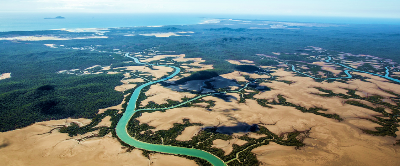
© WWF / James Morgan
The health of tropical coastal ecosystems, such as mangrove forests and coral reefs, often depends on upstream river conditions – and conservation efforts of coastal ecosystems can be undermined when these river conditions change. To draw attention to this challenge and increase holistic river-coastal management, WWF has recently launched an ambitious ten year initiative – Blue Rivers. Blue Rivers will be the catalyst for a new global approach to integrated landscape to seascape conservation. WWF will demonstrate this in priority locations where we and our partners work, and by acting as an influencer to bring this approach to scale and global attention. By addressing and protecting river health around the world, we can help safeguard crucial coastal ecosystems.
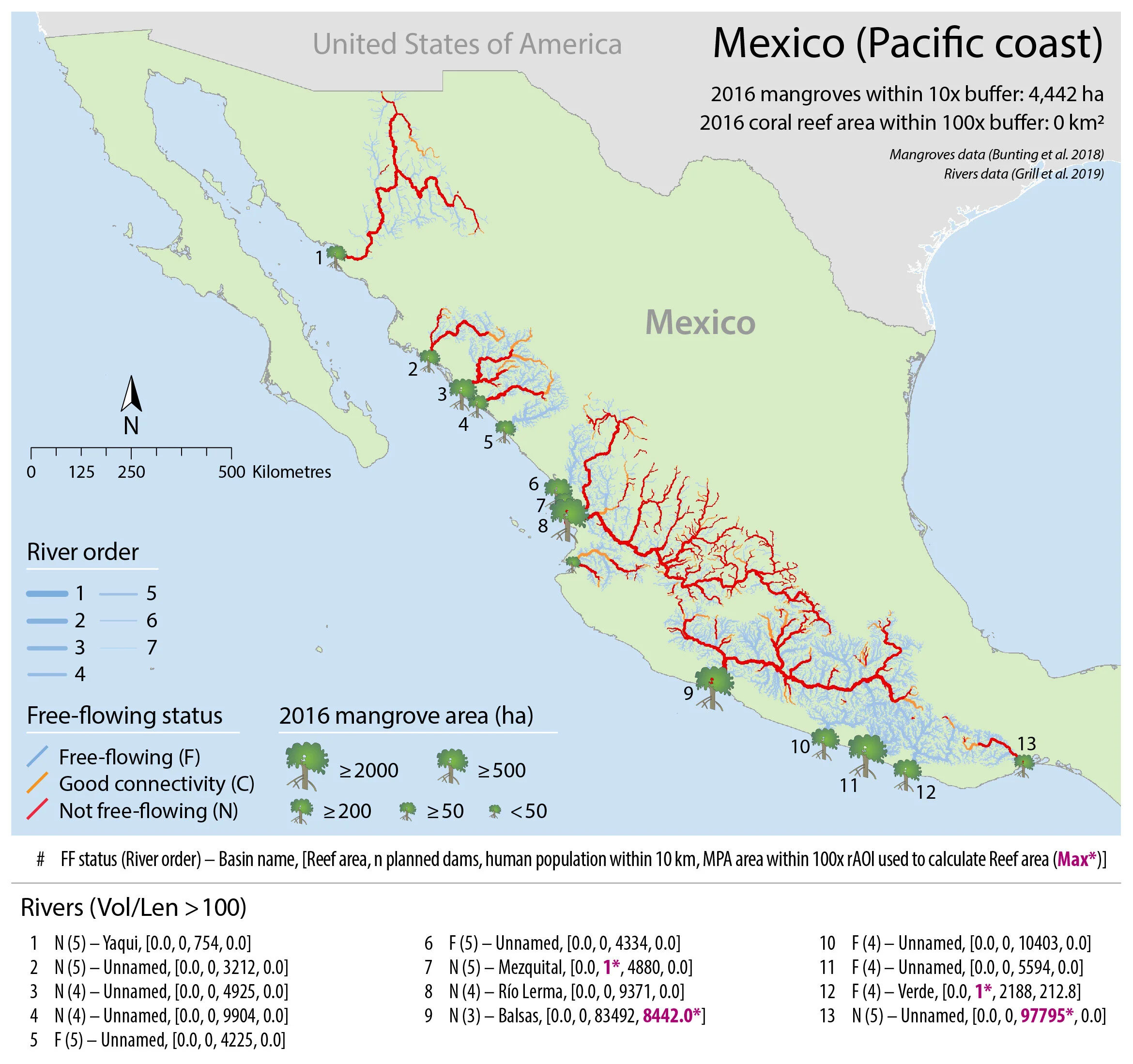
Blue Rivers Phase 1 (2020) seeks to identify how human impacts on rivers have affected coastal ecosystems and identify priority rivers and coastal areas. WWF scientists and partners completed an analysis of novel global datasets on rivers, dams, mangrove forest area from 1996–2016, coral reefs, marine protected areas, and human population density. We found that human impacts on rivers are important predictors of coastal ecosystem loss. Mangroves were lost near rivers at 15% higher rates than the global average, most strongly driven by coastal erosion caused by sediment trapping from dams on rivers. This is the first global-scale study showing that sediment trapping on rivers is a major global contributor to mangrove loss. The analysis also provisionally identified 32 rivers across 21 countries that have high potential to be Blue River priorities for conservation of mangroves and reefs.
Infographics were developed for 20 countries from the analysis. Infographics provide nation overviews of river size, mangrove area and change, river health, coral reefs, marine protected areas, human population density, and more.
Our analysis found that mangroves were lost as soon as sediment was trapped by dams – often showing rapid decline. Juxtaposing data on current and future dams is a key component to inform future conservation efforts. For example, coastal marine protected areas are likely to be most effective for mangroves where adjacent river
sediment trapping levels are currently very low and dams or impoundments are not planned in the near future. There are 263 rivers across 35 countries that are free-flowing and adjacent to mangroves or reefs and have no future dams planned. Conversely, approximately 3,700 large dams are under construction or in advanced planning stages globally. Many of these rivers will be integral to maintaining natural conditions and applying integrated management to advance toward a vision of healthy connected river and coastal ecosystems. Coastal conservation interventions in these locations must anticipate the impact of these dams, and either—where appropriate—lobby to prevent construction, or plan mitigation measures.

Mozambique mangrove status and trends near rivers
Mozambique experienced a 7% national decline in mangrove cover from 319,445 ha in 1996 to 298,552 ha in 2016. Of the 18 largest rivers in Mozambique, 11 are free-flowing – and so had low human impacts. Five rivers, however, had significant human impacts and (“not free-flowing”). All five of these rivers are in southern Mozambique and have experienced substantial losses of mangrove area: for example, the Zambezi (River 13) lost 1,304 ha of mangroves between 1996 and 2016. Coastal conservation must address the significant upstream impacts to be effective.
Mexican (Atlantic coast) rivers, coastal ecosystems, and protection status
Contextual information on extent of mangroves, coral reefs, and existing MPAs within the area of influence of rivers. The current human population and proposed future dams are shown. For example, the Coatzacoalcos river (number 9) is a free-flowing river that has 12.3 km2 of reefs and but no MPAs within its area of influence. The coastal area adjacent to this river’s endpoint has a population of 309,000. The Coatzacoalcos, however, does not have any current dams or future dams planned, suggesting that MPAs could be effective tools for mangrove protection in this area.
Our next steps are to finalize the list of Blue Rivers based on maximizing potential for conservation impact. This will include locations in South East Asia, the Caribbean, South America, and East Africa. The initiative will build on best practices and local context while applying evidence from the analysis to identify geographies.
During Phase 2 (2020-22) WWF will advocate for these Blue Rivers and adjacent coastal areas at international and regional forums. Momentum generated on the global stage will bolster Phase 3 (2021-25), which will initiate designing and implementing landscape-seascape tailored interventions on the ground. Interventions will include working with local communities to develop alternative livelihoods to reduce mangrove destruction and overfishing of reefs, working with national and regional governments to maintain and advocate for natural flows along the river, supporting area-based conservation, and monitoring ecological and social indicators of ecosystem and population health to inform adaptive management. These interventions build off existing, foundational work in these regions and facilitate the bridging of cross ecosystem management to foster collaboration and communication amongst stakeholders and implementers.
By considering connected ecosystems, this project will maximize conservation impact and increase river and ocean protection in some of the most vulnerable areas globally. Resuscitating ecosystem connectivity and basing decision-making on upstream and downstream conditions will enhance biodiversity and resilience of these places into the future.

To see the full initial report, click here.